Blog
Lucipara Islands Explained: Location, Wildlife, and Access

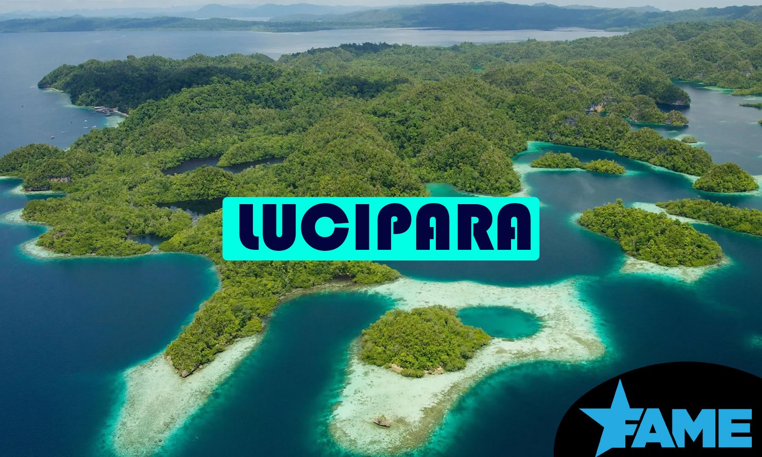
Lucipara is a small cluster of uninhabited coral atolls sitting alone in the middle of Indonesia’s Banda Sea, and most travelers have never heard of it because so few people ever go there. The islands rarely appear in mainstream travel guides, yet divers, fishing charters, and marine researchers increasingly mention them as one of the last stretches of genuinely untouched reef in the Coral Triangle. This article explains exactly where Lucipara sits, what lives in its waters, why conservation groups are paying closer attention to it, and what it actually takes to visit.
What Are the Lucipara Islands?
The Lucipara Islands are a remote group of small, uninhabited coral atolls in the Banda Sea, part of Indonesia’s Maluku province. The five tiny atolls sit atop undersea mountains that rise more than a mile from the ocean floor, which explains the steep drop-offs and clear water divers describe. The group is best known for its sea turtle population, pristine soft coral reefs, and extreme isolation, and it has no permanent human residents.
Where Are the Lucipara Islands Located?
Lucipara sits in the open Banda Sea, well south of the larger Maluku islands and far from any regular shipping lane. The coordinates are roughly 5°29’39” S, 127°32’32” E, and the group lies directly south of the Manipa Strait near Seram, about 50 kilometers west of the Penyu Islands, according to the Lucipara Islands entry on Wikipedia. Most travel accounts place both Lucipara and Penyu around 175 to 200 kilometers south of Ambon, in the middle of the Banda Sea, though the exact figure varies slightly depending on the departure point and route a boat takes.
The islands are sometimes called Pulau-pulau Maisel, and older charts and travel accounts use several other spellings. Local and historical names include Lousapara Islands, Lucapin Islands, Lucipara Eilanden, Lusipari Islands, and Pulau-pulau Lucipara. American diplomat Edmund Roberts recorded the name “Lucepara” after a brief visit in the 19th century, documenting the stop in his 1832 journal. The variation in spelling across the centuries is common for remote Indonesian islands that were mapped by different colonial powers and traders passing through on old spice routes.
What Do the Lucipara Islands Look Like?
Lucipara is not one island but a scattered group of small atolls and reef flats, most of them barely large enough to walk across at low tide. The islands form a cluster of small, uninhabited landmasses surrounded by clear turquoise water, with steep drop-offs along their perimeters and shallow lagoons in the middle. One of the northern islands, Kadola, is one of three islets in that section of the group, and another anchorage point used by visiting boats is known as Bingkudu.
Because the atolls rise sharply from deep water rather than sitting on a continental shelf, the surrounding seas drop off quickly just past the reef edge. That geography is part of why Lucipara attracts both divers chasing wall dives and pelagic fish that prefer open water close to structure.
What Wildlife Lives in and Around the Lucipara Islands?
Lucipara is best known for its marine life, and the number of species reported at such a tiny, uninhabited site is unusually high for such a remote location.
Sea Turtles
Sea turtles are the animal most closely associated with Lucipara, and the islands function as an important nesting and feeding site in the Banda Sea. Visitors have reported turtle nesting tracks on the beaches and green turtles resting in caves along the reef, though turtles here tend to be shy because they are still hunted in parts of the region. The combination of quiet beaches, warm water, and minimal human disturbance makes the atolls valuable turtle habitat even without formal protection in place yet.
Fish and Coral
The reefs around Lucipara support a wide range of reef and pelagic fish. Napoleon Wrasse, which are rare in many other parts of Indonesia, along with Red Emperor and large schools of trevally are regularly spotted here. Divers and anglers also report Dogtooth tuna, bluefin tuna, escolar, groupers, barracuda, amberjack, and several shark species around the atolls, in addition to Giant Trevally. The soft coral growth on Lucipara’s walls is frequently described as among the best in Indonesia, largely because the site has seen so little diving pressure or physical damage over the years.
Seabirds
The islands are not only a marine habitat. Lesser Frigatebirds and Red-footed Boobies nest in the trees on the islands, and both species can be seen feeding in flocks over nearby upwellings, where currents push baitfish toward the surface. The presence of tree-nesting seabirds, rather than ground-nesting species, suggests the islands have avoided the heavy predation from rats and other invasive species that damages bird colonies elsewhere in the region.
What Is the History of the Lucipara Islands?
Lucipara sits within a part of Indonesia with a long trading history. The wider Banda Sea region was once central to the historic spice trade, and Lucipara’s remoteness meant it stayed largely unexplored even as ships passed through nearby waters. The earliest documented visit on record comes from Edmund Roberts, an American diplomat who stopped at the islands briefly in the 19th century and wrote about them under the name Lucepara in his 1832 journal.
Beyond that early account, written history of Lucipara is thin, mainly because the islands were never permanently settled and sat outside the main shipping and administrative routes through Maluku. Local communities from the wider region historically used the islands for seasonal activities such as harvesting coconuts, and some traditional fishing still takes place there today, even though no one lives on the islands year round.
Are the Lucipara Islands a Marine Protected Area?
Lucipara is not yet a formally declared marine protected area, but it is actively moving in that direction. The islands have already been allocated within the Maluku Provincial Spatial Plan, covering an area of 388,712.10 hectares under the province’s management authority, which is an administrative step that typically precedes formal MPA designation in Indonesia.
In March 2026, the Maluku Marine Affairs and Fisheries Department, the Coral Triangle Center, and Yayasan Konservasi Alam Nusantara held a joint discussion in Bali aimed at building a shared roadmap for establishing and managing Lucipara as a marine protected area, according to the Coral Triangle Center. Maluku’s provincial government has framed this work as part of a broader push to protect the islands’ ecosystems while also developing them, carefully, as a premier marine tourism destination. Earlier survey work by the Coral Triangle Center, dating back to 2021, gathered ecological and socio-economic data specifically to support this MPA planning process, and the province had already flagged Lucipara for conservation in its zoning plan before that.
In practice, this means Lucipara currently operates under general provincial planning protections rather than the stricter zoning and enforcement rules that come with a fully declared MPA. Divers and fishers who visit today should expect that to change in the coming years as management plans move from discussion into implementation.
How Do You Get to the Lucipara Islands?
There is no scheduled transport to Lucipara. The only realistic way to reach the islands is by liveaboard dive boat or a chartered fishing vessel, almost always departing from Ambon, the provincial capital of Maluku. Most liveaboard routes to Lucipara start in Ambon and sail overnight to reach the atoll, and the crossing itself is a significant part of the trip given how far offshore the islands sit.
Because of the open-water crossing and exposure to swell, the islands can only be reached by boat during a narrow window each year, around the change of the monsoon, when conditions are calm enough to make the trip safely. One documented journey to Lucipara took about 14 hours from Ambon, and other trip reports describe similarly long crossings, so travelers should plan for the better part of a day at sea in each direction, not a quick day trip.
Given the distance and the narrow seasonal window, most visitors book a multi-day liveaboard that includes Lucipara as one stop within a longer Banda Sea itinerary, rather than a dedicated trip to the atolls alone.
What Can You Do at the Lucipara Islands?
Diving is the main draw. The atolls offer wall dives along steep drop-offs, calmer lagoon areas suited to slower exploration, and the chance to see large pelagic species that are harder to find on more heavily dived reefs elsewhere in Indonesia. Fishing charters also use Lucipara for popping, jigging, trolling, and land-based casting, with operators reporting a high strike rate on species like Giant Trevally around the atoll’s edges.
Snorkeling is possible in the shallower lagoon areas for those not diving, though the site’s real appeal, the walls, drop-offs, and larger fish, is best experienced underwater with proper gear and an experienced guide. Because the islands are uninhabited, there are no facilities on land, so every trip is fully self-contained aboard the visiting vessel.
Is It Safe or Easy to Visit the Lucipara Islands?
Visiting Lucipara is not difficult in the sense of needing special permits, but it is logistically demanding because of the distance and the lack of any on-site infrastructure. There is no permanent settlement on the islands, and the nearest support, whether fuel, food, or medical care, is a full day’s sailing away, so trips depend entirely on well-prepared operators who carry their own supplies and safety equipment.
The narrow seasonal weather window matters here too. Attempting the crossing outside the calmer monsoon transition period can mean rough open-water conditions with no shelter nearby. For that reason, Lucipara is best treated as an experienced traveler’s destination, booked through an established liveaboard or fishing charter operator with a track record on this specific route, rather than an independent trip.
Conclusion
Lucipara is easy to miss on a map and hard to reach in practice, and that combination is exactly why it has stayed so intact. The atolls hold some of the healthiest soft coral and the most consistent turtle activity left in the Banda Sea, and Maluku’s provincial government is now working with conservation groups to formalize protection before tourism or fishing pressure grows further. For now, Lucipara remains a destination for well-prepared divers and anglers willing to make a long crossing rather than a stop on any standard travel itinerary, and that is likely to change only slowly in the years ahead.
Frequently Asked Questions
Where exactly is Lucipara located?
Lucipara sits in the open Banda Sea in Indonesia’s Maluku province, south of the Manipa Strait near Seram and roughly 175 to 200 kilometers south of Ambon. It is closer to the Penyu Islands than to any populated coastline, which is part of why the crossing takes so long.
Is Lucipara inhabited?
No. Lucipara has no permanent residents. The islands are visited seasonally by traditional fishers and occasionally by liveaboard dive and fishing charters, but no one lives there year round, and there are no facilities on land for visitors.
Why is Lucipara famous for sea turtles?
Lucipara’s isolation and undisturbed beaches make it valuable nesting and resting habitat for sea turtles. Visitors have documented nesting tracks and turtles resting in reef caves, and the site’s remoteness has helped protect it from the disturbance that affects turtle populations near more populated coastlines.
Is Lucipara a protected marine area?
Not yet, formally. Lucipara is allocated within Maluku’s provincial spatial plan, and the Maluku government is actively working with conservation groups to establish it as a marine protected area, but the formal designation had not been finalized as of early 2026.
How do you get to the Lucipara Islands?
The only way to reach Lucipara is by liveaboard dive boat or chartered fishing vessel, typically departing from Ambon on an overnight or multi-hour crossing. Trips are limited to a narrow seasonal window around the monsoon change, when sea conditions allow safe passage.


Who Is Alisa Earle? The Real Life Story of Alix Earle’s Mother

MyGreenBucks.net Explained for New Personal Finance Readers

Who Is Berry William Borope Robinson? The Real Life Story of Smokey Robinson’s Son

Who Is Roderick Jeffrey Watts? The Real Life Story of Isabel Wilkerson’s Husband

Who Was Christopher Bixby? The Real Life Story of Bill Bixby’s Son

Who Is Carrie Schenken? The Real Life Story of Amanda Bearse’s Wife

Who Is Aidan Thieriot? The Inspiring Life of Max Thieriot’s Brother

Who Was Lauren Maxwell? The Extraordinary Life of Fetty Wap’s Daughter

Who Is Thomas Emil Sicks? The Inspiring Life of Kiefer Sutherland’s Half-Brother

Who Is Michel Sáenz Castro? The Fascinating Life of Verónica Castro’s Son

Who Is Joey Armstrong? The Extraordinary Journey of Billie Joe Armstrong’s Son

Who Is James Daniel Sundquist? The Extraordinary Life of Jimi Hendrix’s Son
-
 Celebrity4 weeks ago
Who Is Aidan Thieriot? The Inspiring Life of Max Thieriot’s Brother
-
 Celebrity4 weeks ago
Who Was Lauren Maxwell? The Extraordinary Life of Fetty Wap’s Daughter
-
 Celebrity4 weeks ago
Who Is Thomas Emil Sicks? The Inspiring Life of Kiefer Sutherland’s Half-Brother
-
 Celebrity1 month ago
Who Is Michel Sáenz Castro? The Fascinating Life of Verónica Castro’s Son
-
 Celebrity4 weeks ago
Who Is Joey Armstrong? The Extraordinary Journey of Billie Joe Armstrong’s Son
-
 Celebrity1 month ago
Who Is James Daniel Sundquist? The Extraordinary Life of Jimi Hendrix’s Son
-

 Celebrity1 month ago
Who Is Nanette Bledel? The Unforgettable Life of Alexis Bledel’s Mother
-

 Celebrity3 weeks ago
Who Is Paris Brosnan? The Remarkable Life of Pierce Brosnan’s Son